
The BIOMASS Satellite Reveals How Much Carbon the World’s Forests Store

ESA
Date of publication:
The BIOMASS satellite of the European Space Agency (ESA) enables, for the first time, the measurement of forest biomass volume from space. New satellite data reveal how much carbon dioxide forests store and how important they are for understanding climate change. Researchers from the Faculty of Civil and Geodetic Engineering of the University of Ljubljana (UL FGG) are also involved in research and education activities
New satellite data on carbon stored in forests
As part of its Earth Explorer scientific programme, the European Space Agency (ESA) launched the BIOMASS satellite in April 2025, providing new insights into the functioning of the world’s forests. Using an advanced radar system, the satellite measures the volume of woody biomass, from which scientists can estimate how much carbon dioxide (CO₂) is stored in forests. Such measurements are crucial for understanding the global carbon cycle and climate change, since forests are among the largest natural carbon sinks on Earth.
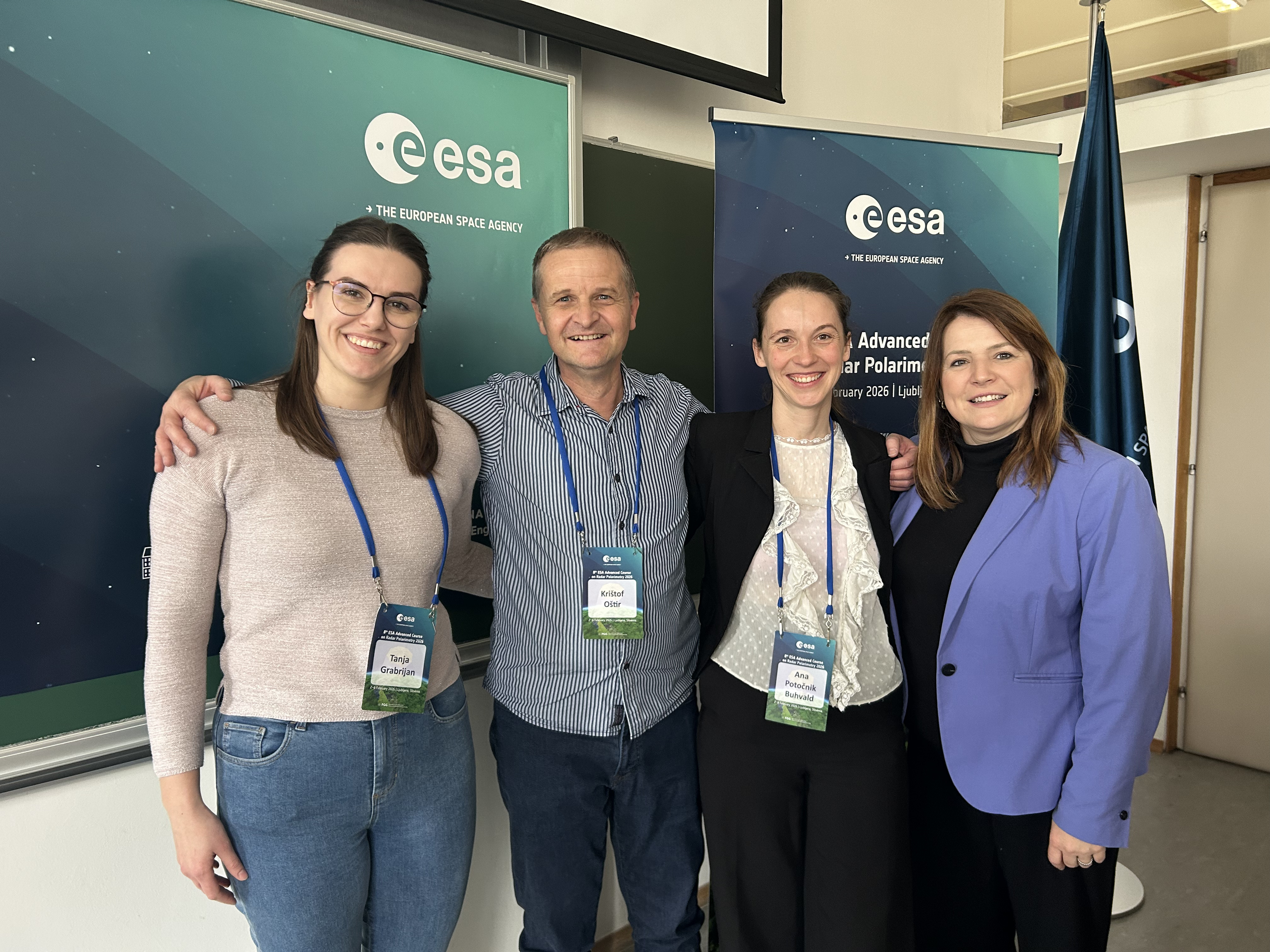
Researchers from the Earth Observation and Geoinformatics research programme at the Faculty of Civil and Geodetic Engineering, University of Ljubljana (UL FGG), are also involved in the research, data analysis and educational activities. Among them are Prof. Krištof Oštir, Dr. Ana Potočnik Buhvald, and Tanja Grabrijan. Processing BIOMASS satellite data is complex and requires the development of new methods for analysing radar satellite imagery, particularly when enhanced with physics-informed artificial intelligence.
Radar that sees through forest canopies
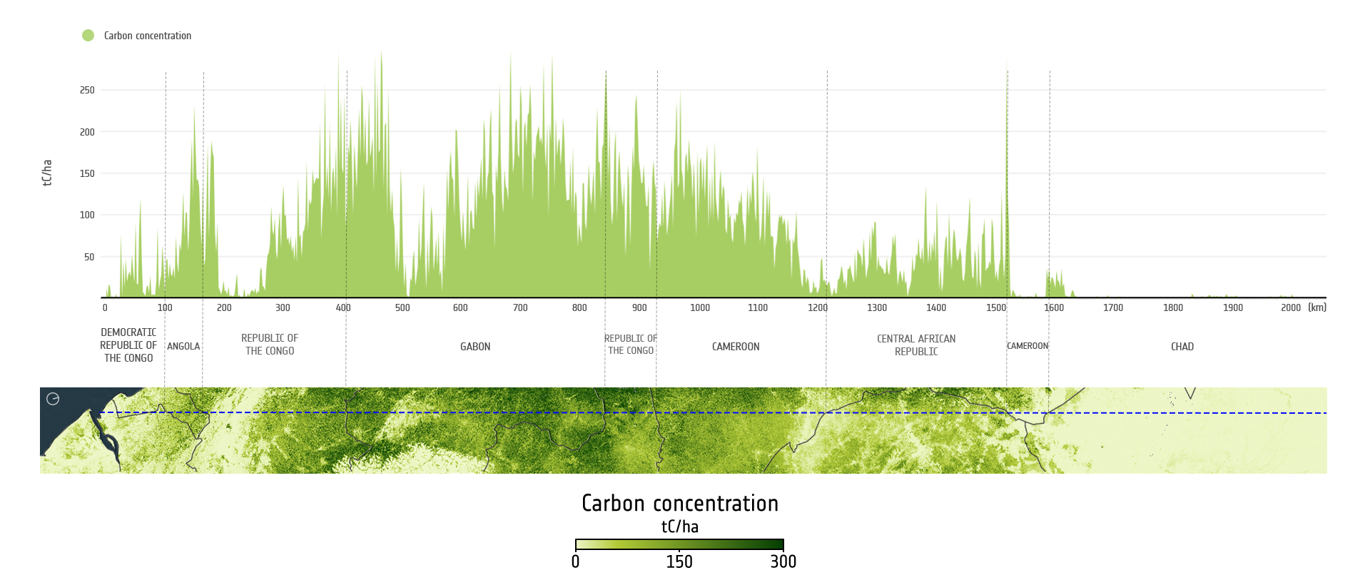
The BIOMASS satellite uses Synthetic Aperture Radar (SAR) operating in the so-called P-band, which has a longer wavelength than most other satellite radars. This signal penetrates forest canopies and reflects from the ground, trunks, and branches, allowing scientists to reconstruct the three-dimensional structure of forests. Based on these data, it is possible to accurately estimate the amount of carbon stored in forest biomass (Figure 1).
Photo gallery
Open satellite data and cloud processing
Data from the BIOMASS satellite is freely available, enabling use by researchers, public institutions, and companies worldwide. A large portion of analyses is performed in cloud computing environments, where vast amounts of satellite data are processed using artificial intelligence and machine learning methods. The main tool for accessing and processing BIOMASS mission data is the ESA Multi-Mission Algorithm and Analysis Platform (MAAP).
To encourage the use of the new BIOMASS satellite data, ESA, together with research institutions, organises numerous scientific events and training activities. In Ljubljana, the ESA PolInSAR BIOMASS international conference was held at the Faculty of Arts of the University of Ljubljana in late January 2026, bringing together more than 200 researchers from around the world. A week after the conference, the Advanced Course on Radar Polarimetry took place at UL FGG. Participants gained knowledge on radar polarimetry, interferometry, and BIOMASS satellite data processing. The programme also included practical workshops where participants worked with real satellite data to develop research approaches for analysing forests, glaciers, and deserts.
Photo gallery
Satellite data for understanding the planet
In the coming years, the BIOMASS satellite will enable more precise monitoring of changes in forests and their role in the global climate system. The new satellite data will help scientists better understand how carbon moves between vegetation and the atmosphere and how changes in forests influence the climate. Beyond forest research, the satellite also opens new opportunities in other fields. Due to the long radar wavelength, the signal can penetrate glaciers and dry, sandy areas, enabling studies of the internal structure of ice sheets and the detection of hidden geological and archaeological structures in deserts. Such information is important for climate change research, sustainable forest management, and the development of environmental policies based on reliable scientific data.
The University of Ljubljana is also part of a European training consortium
Researchers from UL FGG participate in the international ESA EO Training Academy educational consortium, funded by ESA. The consortium connects European universities and research institutions in the field of Earth Observation (EO). The consortium develops educational materials and organizes professional training, courses, webinars, and research challenges for students and researchers. UL FGG participates as a key partner, contributing to the development of teaching materials, the organisation of international training events, and the dissemination of knowledge on the use of satellite data. Materials from the completed courses are freely available on the digital learning platform EO Colleg – Digital learning, sustainable future, as well as on the ESA EO Science for Society (eo4society) portal, where lectures, practical exercises, and other learning resources are accessible.
